
Town of Pittsford ZIP Code Coverage
The Town of Pittsford ZIP code directory has two postal assignments directly verified in the local research. The core Pittsford assignment is 14534. Official town materials also use Rochester 14618 for Town of Pittsford locations. That second result is not an error to be corrected by guesswork. It is evidence that a postal city and a legal municipality are separate layers. An address-specific USPS result remains the authority for an individual house.
| ZIP | Verified Town of Pittsford context | Post office | Record-search note |
|---|---|---|---|
| 14534 | Many Town and Village of Pittsford addresses and town facilities | Pittsford Post Office, 5607 Palmyra Road | Core Pittsford postal assignment; it is not an incorporation boundary. |
| 14618 | Official town examples, including East Avenue and Allens Creek Road locations | Rochester-area delivery; a specific station was not verified | A Rochester mailing city can still be a Town of Pittsford parcel. |
The Pittsford Post Office is listed at 5607 Palmyra Road, Pittsford, NY 14534-9998, with weekday hours of 8 a.m. to 5 p.m., Saturday hours of 8:30 a.m. to 1 p.m., and phone 585-586-1230. Nearby ZIPs such as 14610 and 14625 are not published here as Town of Pittsford coverage because the research did not verify them through official town, USPS, or county sources. Keeping unverified nearby ZIPs out of the table avoids turning proximity into a boundary claim.
Pittsford ZIP Boundary Layers
Town of Pittsford, Village of Pittsford, Monroe County, postal city, postal ZIP, and tax parcel can all describe the same address from different angles. The official town map places the village within the town and shows nearby Rochester, Brighton, Mendon, Perinton, and East Rochester relationships. A mailing label answers where the Postal Service delivers mail. It does not establish which town, village, school, or tax jurisdiction has authority over the parcel.
This distinction is especially important along the Monroe Avenue and East Avenue corridors and in areas near town lines. The town map and street index can help normalize a street name, but a tax-map number and legal description are the continuity anchors. The property’s situs is the physical parcel location. The tax-roll mailing address is where notices are sent. A deed’s legal description identifies the lot, subdivision, or metes-and-bounds description that can remain useful when ordinary address wording changes.
Verify Pittsford Postal ZIPs
Use the USPS ZIP Code Lookup before entering a ZIP in any local record system. The city and state mode checks a postal locality, while the street-address mode is the better choice for one exact address. Preserve the returned ZIP+4 when it is relevant to delivery. This is a postal validation step, not a substitute for the county parcel map or a way to identify all people within a ZIP Code.
The USPS city and state lookup shown here confirms the postal side of an address.
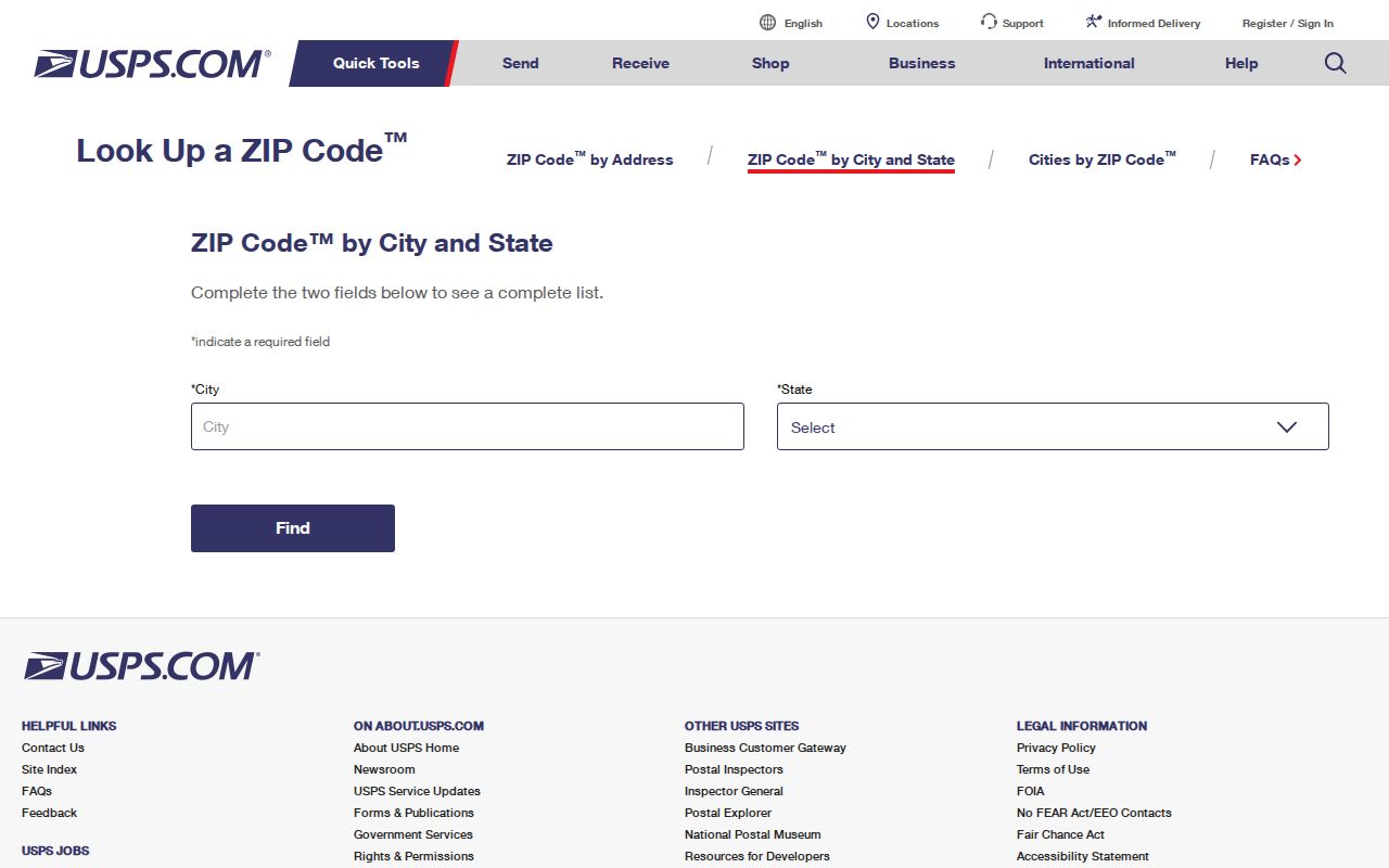
After USPS returns a result, save the postal city, ZIP, and ZIP+4 separately from the municipal and parcel data. A future property, voter, or deed search can then use the right identifier for that custodian instead of forcing a delivery label into a tax or title field.
Pittsford Voter ZIP Lookup Fields
The Monroe County voter lookup visibly accepts ZIP Code along with details that identify one person. It is useful after an address and name have already been narrowed. The service advertises registration information, polling place, sample ballot, absentee or mail-ballot status, and elected-official context for a matched individual. It is not a ZIP-wide people list, and it does not show ballot choices.
| Field label | Type | Use or format |
|---|---|---|
| Street # | Text or number | Enter a house number when known. |
| Street Name | Autocomplete or dropdown | Start typing and choose the displayed street. |
| ZIP Code | Text or dropdown | Use the postal ZIP verified for the address. |
| Last Name | Text | Use the current registration spelling. |
| Date of Birth | Date text | MM/DD/YYYY. |
New York Election Law §3-220 protects driver-license, non-driver ID, Social Security, and facsimile numbers in registration records. A statewide voter-data request also requires an elections purpose under §3-103(5). Use the individual tool to corroborate a known person, not to create a ZIP roster.
Pittsford Parcel and Postal Details
The Town of Pittsford assessor page directs property research to the county Real Property Portal and reports that the town assesses at full value. The visible 2025 tentative assessment roll includes Tax Map Parcel Number, Property Location and Class, Assessment, Exemption Code, Village, County, Town, and School. Those columns help sort postal and tax geography. They do not establish a list of occupants, and the research did not confirm a ZIP filter in the live county portal because the interface was blocked.
Mapping Monroe is the practical map cross-check. Its documented tools include house number, house owner, identify polygon, layers, reports, print, and share. Search the address or owner when the current interface permits it, identify the parcel, and compare the map with the USPS answer. The GIS description does not document a ZIP-wide browse mode, so it should not be represented as a postal directory or bulk export.
| Address component | What it means |
|---|---|
| Situs or property location | The physical place where the parcel sits. |
| Mailing address | Where tax notices are sent, which may be elsewhere. |
| Tax map parcel number | The identifier for the tax unit. |
| Legal description | The deed’s lot, subdivision, or boundary description. |
| Postal ZIP | Delivery geography, not a legal property boundary. |
Finding Pittsford Residents by ZIP
A ZIP Code is most useful after it is tied to a specific person or address. The public local tools do not support a verified ZIP-wide resident export. The voter tool requires a known individual’s details. The county property page describes property, tax, history, and sales functions, but research did not verify a ZIP search field. The GIS viewer has address and parcel tools rather than a documented postal browse. Keep the search narrow and retain the source that supports each conclusion.
- Enter the exact street address in USPS and record the postal city, ZIP, and ZIP+4 returned for that address.
- Open Mapping Monroe and identify the parcel by the address or house number, then note its tax-map number and municipal context.
- Use the Monroe voter lookup only when a known person’s street, ZIP, surname, and date of birth are available.
- Compare parcel situs and mailing information with the postal result. Do not substitute one for the other.
- When the ZIP has narrowed the place to a street, use the Town of Pittsford street directory for the address-by-address record trail.
For an individual name, a voter match can be cross-checked with recorded deeds or the assessor route. For an older address, start by preserving the historic street spelling and number. Modern postal labels cannot be projected backward into records that predate ZIP Codes.
Pittsford Historic Postal Checks
Historical directories and street guides predate ZIP Codes, so an older Town of Pittsford address needs translation before it is searched in a current postal tool. The research confirms that RPL directories are useful for historic address eras, but a directory’s year and editorial conventions must stay attached to the result. Preserve the original road name, abbreviation, house number, and publication year first. Then bridge it with a parcel number, plat, legal description, or map rather than guessing a present-day postal assignment.
Town history and map material document changing development patterns and earlier settlement names, but no official Pittsford-wide street-renumbering project or year was verified. The safe comparison is therefore address to parcel, not old number to new number by assumption. The 1937 street guide uses cross-street relationships for roads such as Reeves, San Rafael, Schoen Place, South, and Sutherland. Those relationships can help locate an old entry before a current GIS parcel and postal result are compared.
Town of Pittsford Postal Limits
A Town of Pittsford ZIP code directory should not turn a postal result into a resident list. A ZIP tells the Postal Service how to deliver mail. It does not show title, tax jurisdiction, every household member, voter status, or town limits. The Clerk deed index is keyed to names, document types, dates, legal descriptions, book and page, file number, and quick searches, not to a ZIP directory. Use each record system for the question it is built to answer.
- ZIP versus ZIP+4
- A five-digit ZIP identifies a delivery area; ZIP+4 adds a smaller delivery segment for a more precise address.
- PO box ZIP
- A ZIP used for post-office boxes rather than every physical address in an area. No Town of Pittsford PO box-only ZIP was verified in the research.
- Unique ZIP
- A ZIP assigned to one institution or organization. No verified Town of Pittsford unique ZIP was located.
- Carrier route
- A Postal Service delivery grouping within a ZIP; it is not a municipal or parcel boundary.
Search boundary. Use a ZIP to verify delivery and narrow a known address; do not use local public records to compile or infer a private household roster.